Unveiling the Depths: Surface Investigation Services
Welcome to Visiontek Consultancy Services’ Surface Investigation Services, where we unlock the secrets of groundwater resources and surface water bodies.
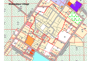
We have a team of land management experts who are versatile in all activities relating to land acquisition, alienation, identification of suitable site for green field project. We undertake activities like Drone Survey, Geo-reference maps, super imposition of village revenue sheets and digitalization of revenue sheets for land record survey as well as for preparation of documents for various projects
To improve the basic infrastructures in all departments of Government and Industrial Sectors for economic development, VISIONTEK conducts Topographical Survey using modern technology such as DGPS, Total Station, Auto-Level etc to study the ground level with reference to MSL and location of the terrain. We provide accurate horizontal and vertical measurements to provide complete topographical maps giving clear indication of boundaries, features and levels of all the existing features within your site that will help you in preparation of suitable plan for the proposed project.
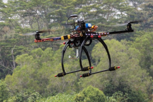
VISIONTEK is a pioneer of all types of surveying for infrastructure development and socio-economic growth of general mass using modern technology and software. For capturing high-resolution aerial images and other spatial data, drones are used for aerial survey. The data captured by drones are processed by us using specialized software to create 3D models, Ortho mosaic maps, and other survey outputs which are used for monitoring construction progress, assessing crop health, mapping land boundaries, conducting geological surveys and measurement of volumes.
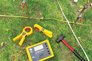
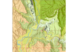
We conduct hydrogeological survey and ERT for Field Investigations, Geological Mapping, Hydraulic Testing, Aquifer Studies, Data Analysis and Interpretation and Reporting. We take up systematic study to assess and understand the characteristics, behaviour and distribution of groundwater in a specific area or region for sustainable management of groundwater resources, especially in areas where groundwater is a significant source of drinking water or irrigation. Our input provides valuable information to policymakers, engineers and environmental scientists to take decisions regarding groundwater extraction, pollution prevention and conservation measures.
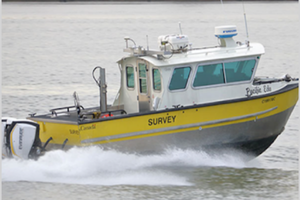
We undertake Hydrographic Survey, collection and processing of data to assess the underwater contours, water depths, hydraulic features of currents, waves and tides as well as depth and characteristics of sediments. It assesses the under water hazards and helps in maintenance of hydraulic infrastructure by providing accurate information about site conditions and environmental factors, enhancing the safety and efficiency of navigation and transportation systems as well as supporting the process of management and conservation of water resources and ecosystem.
We conduct geological survey and systematic study for assessment of the geological features, structures, mineral deposits and resources present in a specific area or region of the Earth's crust through combined use of various scientific disciplines such as geology, geophysics, geochemistry and remote sensing. This enables the client agencies to take judicious decisions for Resource Exploration, Environmental Assessment, Natural Hazard Assessment, Infrastructure Planning and Scientific Research.